Quantcast
Channel: One Hundred Mountains
Viewing all 568 articles
Browse latest View live

Sucker hunch

$
0
0
In Japanese river climbing, unusual challenges demand special solutions

Surly and turbid was the mood of the Tamba River, swollen by the June rains. A sneak eddy had already taken down N-san. He bobbed up again, but not his spectacles, alas.

Now, on a gravel shoal ahead, Sawa Control was setting up a belay. “You can do this,” he said, handing me the wet end of the rope. This time, though, he would be wrong.

Flailing my way across the foaming pool was no problem – but, upstream, where the gorge narrowed, the current speeded up. As Mr Micawber might have said, had Charles Dickens been more into river climbing, “Swimming speed, two knots; flow rate, three knots: result, ignominy.”

Climbing round the impasse didn’t appeal; the gorge was sheer. As for hauling oneself upstream, no crack or hold came to hand on those slimy walls of chert. Try as we might, the river kept flushing us back into that foaming pool. Eventually, we had to give up – we’d come back when there was less water.

Back at home, reading a ‘how-to’ book, I realised we’d lacked a vital piece of kit. That’s right; the humble drain unblocker. Slap one onto a hopelessly smooth wall (see right) and you can haul yourself forward against raging torrents of moving water. Indeed, the slimier the rock, the better it sticks.

For really critical passages, you might even consider a brace of them - one in each hand, like ice-climbing tools (only cheaper). But don’t forget to lanyard your unblockers to your belt. In strong currents, as any sawa-naut will tell you, there’s a sucker borne away every minute …


References

Yoshikawa Eiichi, Sawa nobori: nyumon to gaido, Yama to keikoku, 1990 (black-and-white photo is from this book)


Hotly debated ice

$
0
0
How a pioneer alpinist helped to push the case for Japan’s vanished glaciers.

Summer 1902 was a pivotal season in the history of Japanese mountain exploration. On August 17, the banker and journalist Kojima Usui (1873-1948) scrambled to the top of Yari-ga-take. “For why?” he later explained, “Because Yari is high, Yari is sharp, and Yari is steep.” This was the first time that anybody had expressed a modern, alpinistic impulse in Japanese. Novel though it was, the rationale soon caught on. A few years later, Kojima founded Japan's first alpine club.

Evidence for ancient glaciers? The striated "Red Rock" on Shirouma
In the very same month, a young geographer strode over the summit of Shirouma, another high peak in the Hida mountains. Yamasaki Naomasa (1870-1929) had just returned from Europe, where he'd studied under the greatest glaciologist of the age, and he knew exactly what to look for. On his way down the Great Snow Valley, he found telltale scratchmarks engraved on a streamlined red boulder. To the expert eye, this suggested that an ancient glacier had once scoured the valley.

Yamasaki Naomasa
Back in Tokyo, Yamasaki announced his discovery in a public lecture delivered in September of the same year. “Did Japan really lack glaciers? (氷河果たして本邦に存在せざりしか),” he asked, rhetorically, before setting out the opposite case. This was a provocative thesis for a young academic who’d just started on his first job, as a geography teacher at the Tokyo Higher Normal School.

Few were convinced. Sceptics found plenty of ammunition: where in Japan, they asked, can you find the obvious moraines and “drifts” of pulverised rubble that so obviously marked the extent of Europe’s ancient glaciers? The naysayers had a point: the missing moraines didn't show up clearly until aerial photography revealed them long after the second world war.

Kojima soon got to hear about Yamasaki's first glacier lecture, although he didn’t attend as he’d “only just laid aside his travelling clothes”. Already, an “indelible association” was forming in his mind between Yamasaki, the Hida mountains and glaciers. And he was deeply impressed that the scholar had seen traces of ancient glaciation where they’d been missed by all those expert foreign mountaineers who’d roamed the Japanese mountains in the previous century.

Kojima Usui
When, in September 1904, Yamasaki announced another public lecture at the Tokyo Geographical Society, Kojima was quick to attend. Before Yamasaki came to the podium, the banker had to sit impatiently while another speaker held forth on the phrenology of natives in the Hietsuno district – not a topic that Kojima had much sympathy for. When the geographer did appear, he'd chosen a less tendentious title for his lecture – “Characteristics of the high mountains (高山の特色)” – but the case for ancient glaciers was, if anything, even more strongly argued.

Kojima made his pencil fly over his notebook as he scribbled down Yamasaki’s observations. “My Yari!” he thought, as the geographer showed a sketch of the spire-like peak. Yamasaki went to mention Kuro-dake, Yakushi-dake and Otenshō-dake – a peak that Kojima had never heard of – mountains that had attracted his attention on a recent trip through the Kurobe river valley. “All these peaks are exceedingly sharp, like the blade of a chisel,” the geographer noted. Could it be that ancient glaciers had shaped them?

Some time after this lecture, Kojima joined the Tokyo Geographical Society. His election was proposed by Yamasaki and Shiga Shigetaka, the author who had inspired Kojima's trip to Yari and who was (or would soon be) an honorary vice-chairman of the Japanese Alpine Club.

Yarigatake in 1902
For his part, Yamasaki helped to advertise the new alpine club by publishing an announcement in the January 1906 edition of the Tokyo Geographical Society’s journal. And he was quick to join up himself. His support may partly account for the strong showing of scientists within the club’s membership roll. Yamasaki and Kojima became firm friends – it might have helped that they were more or less the same age and were both born in Shikoku – although it’s not recorded that they ever went on a mountain expedition together.

Meanwhile, evidence continued to pile up for past glaciation in the Japanese Alps. On November 22, 1913, Kojima attended a particularly “unforgettable” lecture at the Geographical Society. After Yamasaki had again spoken about glacial action in the Hida Range, the (rather small) audience crowded round a desk to inspect the disputed “Hettner stone”. This scratched-up block of biotite granite had been discovered beside the Azusa river near the village of Shimajima by Alfred Hettner (1859-1941), a visiting German geologist.

As the room darkened on this winter evening, candles were brought out to illuminate the stone, picking out the fine parallel lines on its pale surfaces. The striations were compared with those on similar rocks brought from Europe, while Jinbō Kotora (1867-1924), a geologist best known for his surveys in Hokkaido, fired off volleys of questions. According to Jinbō, such scratches could easily be explained by ordinary weathering processes or the action of avalanches.

In 1915, Kojima’s bank sent him to the United States to run its Los Angeles and San Francisco branches. A prolific letter-writer, he kept in touch with Yamasaki. In late May 1922, the geographer visited San Francisco on his way back from a geological conference in Brussels. By this time, Yamasaki was well established in his career – he’d moved in 1911 to Tokyo Imperial University as a professor of geography within the natural science department and, in 1919, he’d set up an independent geography department.


Checking into the Fairmont Hotel on Nob Hill, Yamasaki wasted no time in paying a visit to the Kojima family at their bank-owned residence in Pine Street. Lacquered boxes of “gomokuzushi” were served and Kojima was gratified to see how Yamasaki cleaned his bowl down to the last grain before laying his chopsticks neatly down: the professor seemed to have a pent-up appetite for Japanese food after subsisting for so long on western fare.

Then Kojima took his guest on a sight-seeing drive round San Francisco. At the Golden Gate Park Museum, they admired a landscape by Sadahide. The ukiyoe print may have intrigued Kojima, the art critic and collector, more than it did Yamasaki, the scientist. At any rate, the conversation during Yamasaki’s stay centred mostly on glaciers. By this time, of course, Kojima had seen plenty of glacial landforms for himself, on excursions to the Sierra mountains.

But what about those ancient glaciers of Japan? Yamasaki reported that Professor Penck, on seeing a photo of Yari, had said that it suggested a glacial horn. As Albrecht Penck (1858–1945) had elucidated Europe’s four most recent ice ages, this was a powerful endorsement. Of course, it was also an endorsement of Yamasaki himself, who’d studied under Professor Penck in Vienna during his European study tour around the turn of the century. By 1922, glacier sceptics were starting to lose ground in Japan; within the geographical community, Jinbō Kotora was the most prominent hold-out.

To round off his visit, Yamasaki wanted to visit Yosemite, famous then as now for its towering glacier-carved cliffs. But this could not be; all accommodation in the valley was booked out for a conference of national park employees and not even Kojima’s formidable web of connections could get them a room.

In the end, the Yosemite impasse may have been no more than a minor disappointment. By this time, after all, mountain topography represented only a minor focus within the magisterial sweep of his academic interests: Yamasaki's magnum opus, completed in 1915, was a 10,000-page regional geography covering all of “Great Japan”.

By the same token, it’s unclear what the geographer gained from his contact with the Japanese Alpine Club beyond a sympathetic hearing for his glacial theories. His most important field trips to the Japan Alps appear to have been undertaken independently of Kojima or other club members.

In the opposite direction, though, Yamasaki’s influence was profound. Wielding his ever-busy pen, Kojima was quick to tackle the subject of glaciers. Yamasaki’s theories feature in an essay on “High mountain snows” (高山の雪) published in 1911 in a magazine for students – although Kojima chose to stay neutral in this venue on the question of whether glaciers actually had existed in Japan.

Why should a banker and hobby writer bother with the science of ice and snow at all? As if to justify straying from his usual journalistic terrain, Kojima takes care to explain himself in the essay’s opening section:

I believe that, just as things go in or out of fashion, there are old and new styles of nature. … Modern man can’t be satisfied with appreciating nature in the time-worn shape of famous places and set-piece sceneries such as the Eight Great Landscapes of the Home Provinces or Dawn over Futami-ga-ura. Rather, it is the unknown and the untracked that attracts the spirit of exploration which surged forth so remarkably in the nineteenth century, allied as it is with the spirit of scientific enquiry. As a result, mountaineering clubs have now been established in every civilised nation, first in Europe and America, and latterly in Japan. For what are the mountains but vast vertically framed museums or galleries for the panoply of natural phenomena? Nothing could be more fitting, then, as a subject for investigation than snow.

Viewed in this light, the scientist and the alpinist are kindred spirits. There’s an element of legerdemain in Kojima’s exposition, given that science had played little or no part in the original inspiration for a Japanese alpine club. Yet, once the club was established, scientists did flock to join. And, quite naturally, glaciers did loom large in the minds of the early alpinists. Arguments for and against their former existence in Japan flew to and fro in early editions of “Sangaku”, the club’s journal. And, when it was debated in the same pages whether Honshu’s highest mountains might be dignified as “Alps”, glacial landforms were adduced both for and against the case.

Ultimately, both Yamasaki and Kojima prevailed. The "Japanese Alps" were well on their way to taking root before Kojima left for America. Glaciers took longer to establish. As late as 1918, no less an authority than Walter Weston would side with the naysayers after weighing up the rival arguments. And it wasn't until after Yamasaki's death that the majority of geologists were persuaded that ice-streams had once coursed through the high mountains of Japan.

A final vindication for Yamasaki came just a few years ago when researchers found “live” relic glaciers  under permanent snowpatches on and around Tsurugi-dake. A century or so after the pioneer alpinist and the young geographer explored the Hida mountains, Japan at last has both Alps and the glaciers to go with them.

References

Main source for this post is Kojima Usui's essay on "How I met Yamasaki Naomasa in San Francisco" in Arupinisto no Shuki ("An Alpinist's Journal"), Heibonsha edition, page 85ff. Kojima's article on high mountain snows is republished in "Nippon Alps", Iwanami Bunko, page 240ff.

Walter Weston summarised the debate on Japan's glaciers in "The Playground of the Far East" (1918), Chapter IX "The Northern Alps Revisited", pages 190-96 in the original edition.

Details of Yamasaki Naomasa's academic career are from this outline biography by Brian Welde (University of Missouri) and Mark Eiseman (Valparaiso University).


The golden decade

$
0
0
Mountaineering in the days before modern maps

Everyone has a golden age. Kojima Usui’s started in 1905, when he instigated the Japanese Alpine Club, and lasted until the mid-teens of the century. That was when the Army surveyors started publishing the first modern maps of Honshū’s high mountains, stripping them of mystery. Until then,  the gentlemen alpinists had to follow their noses and, of course, their expert guides.

On the col below Warusawa-dake (photo taken on Kojima's 1909 expedition)
Within a year of its first meeting, the new club attracted several hundred members. Many were quick to fan out into the mountains. In 1906, Ogino Otomatsu led a party across "the innermost mountains of Sunshū Tashiro" (soon to be rebranded as the “Southern Alps) and discovered, or at least identified, Warusawa-dake. Originally written up in Sangaku, the club’s journal, the story is re-told in Nihon Hyakumeizan:

"From time to time, we could see through the trees, on the other side of the valley, a mighty peak, bare-topped and reddish, in the midst of the Akaishi range. When I asked Kōhei, our hunter-guide, what it was, he called it Warusawa on account of the extremely dangerous gully that drains the waters of this mountain into the Nishimata. This sounded much as if he had just said the first thing that came into his mind. As there are neither books nor people to tell you the names of the mountains, rivers, and places hereabouts, I am recording everything just as I hear it from Ōmura Kōhei."

Survey marker on Mae-Hodaka (1909)
There was even a golden year within the golden age. According to Kojima, this was the exceptionally productive season of 1909. In July, Sangaku-kai men climbed rugged Tsurugi, a first for amateur mountaineers. On the summit, they found the survey marker erected by the Army surveyors, two years previously.

Such encounters were not uncommon.  For all of Japan’s high mountains had been climbed before – indeed, people had been climbing most of them for centuries. So there was base alloy in this golden age. Kojima had borrowed the term from the early European alpinists, who'd fought their way to the top of icy unclimbed peaks. In Japan's golden age, by contrast, the first ascents had all been done long before.

This was a truth that repeatedly obtruded. Back in 1902, Kojima had hoped to make the first ascent of Yari-ga-take, then thought by some to be Japan's second-highest mountain. Instead, he found an Army survey marker waiting for him on the summit. Much the same thing happened in 1909, when he led an expedition into the Southern Alps. Atop Warusawa-dake, his party found signs that others had been there before them:

Three shrines of unvarnished wood stood there and a rusted iron banner leaned into a rocky niche. And nearby, the pilgrims had left scattered on the ground wooden tablets inscribed with the name of the deity Arakawa Daimyōjin. (Nihon Hyakumeizan).

Survey tower on Akaishi
When they got to Akaishi-dake, they found a more modern memento – a survey tower of such heroic proportions that they felt obliged to have their group photo taken in front of it. And there they all are, the leading activists and pioneers of the early Sangaku-kai: Kojima Usui himself (second from left, front row), Takano Takazō, the naturalist, Takatō Shoku, the club’s bankroller, Nakamura Seitarō, the fledgling artist, and Saegusa Inosuke, who could claim the first modern ascent of Kita-dake.

Still, a golden age is what you make it. In the same memorable summer, Udono Masao, a civil servant on leave from Korea, achieved what was almost certainly the first crossing of the Dai-Kiretto. No monk or surveyor had ever ventured onto this fearsomely exposed ridge between Kita-Hodaka and Minami-dake in the Northern Alps.

And sometimes the Sangaku-kai men made genuine geographical discoveries, as when, in 1907, Shimura Urei, a teacher and pioneer mountain photographer, looked down from the summit of Washiba-dake:

Kojima's expedition sets out
(sketch by Ibaraki Inokichi)
"I saw a small pond below and to the south, for all the world like an eruption crater … this crater on Washiba is probably a surprise for the world."

Soon, the surveyors would come out with accurate 1:50,000-scale maps of the Northern Alps, eliminating the last opportunities for such finds. With the maps would come mountain huts and new hiking trails. Many more people would be able to enjoy the mountains - yet something would be lost. As Fukada Kyuya would one day put it, “Today, mountaineering is much more convenient but it has lost this element of surprise and wonder.”

References

All photos copyright of Yama to Keikoku illustrated history of Japanese mountaineering (目で見る日本登山史 by 川崎吉光、山と渓谷社).

Cirques of controversy

$
0
0
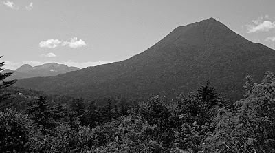
How pioneer Japanese alpinists weighed into the great debate over Japan’s vanished glaciers

"Viewed from afar, the gentle lines of its skyline suggest a serene and settled character. The splendid accents of the ridgeline save the mountain, despite its huge mass, from any hint of ponderousness. These accents are the three cirques that carve deeply into the upper slopes, adding to their form a note of tension … The snow lingers longer in these amphitheaters, outlining them crisply." (Nihon Hyakumeizan, Senjō-dake)
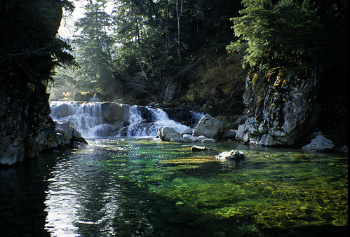
Senjō-dake (photo courtesy of Yama to Keikoku)

When writing up Senjō-dake, a mountain in Japan’s Akaishi range, Fukada Kyūya (1903–1971) pays tribute to the mountain’s elegant cirques. But no guess is hazarded as to how these “splendid accents” could have formed. Fukada may have had reason to avoid this question. For cirques like these lay at the focus of a long-running controversy that lasted well into the writer’s own lifetime. And, like Fukada himself, several of the protagonists were members of the Japanese Alpine Club.

It was Yamasaki Naomasa who started this one. As we have seen in a previous post, it was in the summer of 1902 that the young geographer discovered evidence for an ancient glacier beside Shirouma’s Great Snow Valley. And, on returning to Tokyo, he wasted no time in announcing his findings.

Evidence for ancient glaciers? The striated "Red Rock" on Shirouma
Asking rhetorically, “Did Japan really lack glaciers?” (氷河果たして本邦に存在せざりしか), Yamasaki’s public lecture sent a frisson through academic circles. A summary that appeared in a newspaper article was translated into English – by a Bank of Japan official, no less – and picked up in the February 1903 edition of Science, then as now the most prestigious of scholarly journals.

Alas, few accepted his arguments. Where in Japan, they asked, do you see obvious moraines and deep “drifts” of pulverised rubble –the debris that clearly marks the paths of ancient glaciers all over the Alps or the Himalaya? Undismayed, Yamasaki continued to press his case. In a second public lecture, delivered in September 1904, he suggested that ancient glaciers might have honed the razor-sharp ridges of Yari-ga-take and other high mountains.

Side moraines on the Morteratsch glacier, Switzerland

Still, his peers were underwhelmed. In 1911, the palaeontologist Yokoyama Matajirō published a paper on fossils from the Bōsō Peninsula that purportedly showed that Japan had enjoyed a tropical climate during the Ice Ages. Two years later, this conclusion was overruled by another geologist, Yabe Hisakatsu, who found that the fossils dated from after the Ice Age. But, still, nobody could find the missing moraines and drifts.

Sangaku: the first edition
Given the orographic nature of the subject matter, it was all but inevitable that the debate would spill over into “Sangaku” (‘Mountains’), the journal of the newly formed Japanese Alpine Club – which Yamasaki had joined within a year of its inauguration. Indeed, Yamasaki had contributed an article on the snows of the high mountains (高根の雪) to the very first volume of “Sangaku”, published in 1906.

But Yamasaki was not party – at least, directly – to the controversy launched in the same pages a few years later. In the November 1911 edition, two articles were published, one putting the case for ancient glaciers and the other opposing it. The first, (日本アルプスと既往の氷河) argued that former glaciers had carved out the shapely cirques found on many high ridges throughout the Japanese Alps. A map was included of these suspected glacial landforms, the first ever attempted.

The author was Tsujimura Tarō, then a 21 year-old university student. Tsujimura’s enthusiasm for mountains was such that he too had joined the Japanese Alpine Club just after its inauguration, making him its youngest member. If his “Sangaku” article read like an uncritical redaction of Yamasaki’s views, this should not be surprising: on entering Tōkyō University, Tsujimura had immediately started attending the professor’s lectures.

In 1911, the editor of “Sangaku” was Kojima Usui, the banker and part-time writer who, six years before, had brought together the founding members of the Japanese Alpine Club. Kojima had taken a close interest in Yamasaki’s theories since 1902 and made a point of attending his public lectures. Yet he never allowed his personal friendship with the geographer to sway his independent judgment on the glacier question.

As editor, it is likely that Kojima had the chance to see Tsujimura’s contribution before setting down his own views. His own piece, which was placed after Tsujimura’s, dealt ostensibly with the permanent snowfields of the Japan Alps, with reference to the Hodaka massif, the 3,000-metre peaks that anchor the southern end of the Northern Alps range (日本アルプスと万年雪関係附穂高山論). Effectively, though, Kojima delivered a 29-page rebuttal of Tsujimura’s 19-page article.

The Hodaka massif from Tokugo Pass
Japan’s cirques were formed differently to those of Europe, Kojima noted; their headwalls were less steep, implying that permanent snowfields, not glaciers, had carved them. In this, he followed John Tyndall (1820–1893), the British physicist and pioneer alpinist, who had proposed that snowfields could slip downhill like glaciers, imitating some of their erosive powers.

As for the moraines and the striated rock that Yamasaki had found on Shirouma in 1902, Kojima hadn’t seen them for himself and so he wasn’t able to judge their worth as evidence for ancient glaciers. And he concludes by suggesting that his fellow Japanese alpinists should take up the search for moraines and other glacial landforms.

Yamasaki Naomasa
 In the re-worked version of the article that appears in his collected works, Kojima added a further argument. Japan’s volcanic craters, he observed, only retain their pristine shape if the parent volcano is still active; the moment a volcano falls silent, erosion starts to destroy its features. By the same token, Japan’s cirques are too crisply defined to have been created by glaciers that vanished 20,000 years ago; instead, they must be the product of some continuing agency – namely, the perpetual snowfields that scour them.

At first sight, Kojima’s scepticism seems difficult to explain. After all, the banker was just then tirelessly promoting “The Japanese Alps” as a term for the high mountains of central Honshū. In fact, he’d chosen the title “Nippon Arupusu” to adorn his collected mountain writings, of which the first volume came out in 1910. Not all his peers welcomed this neologism. Yet evidence for ancient glaciers could only have strengthened the case for awarding the alpine brevet to the Hida, Kiso and Akaishi ranges.

Could it be that Kojima picked up his glacial scepticism from Walter Weston (1860–1940), the English missionary and mountaineer? The question is raised by Ono Yugo, Japan’s pre-eminent glacier expert of modern times, whose paper on the 1911 Sangaku debate is the main source for this post. Kojima certainly did take over the concept of the Japan Alps from Weston, who had embedded them in the title of his own memoirs – Mountaineering and Exploring in the Japanese Alps, published in 1896.

It was Weston too who, on his second visit to Japan, had originally suggested the idea of an “Alpine Club” to Kojima. The proposal was floated during a conversation over a pot of tea at Weston’s flat in Yokohama in early 1903 and the club itself was formed two years later, in October 1905. For this contribution, the newly formed “Sangaku-kai” or Japanese Alpine Club promptly elected the Englishman as its first honorary vice-chairman.

Walter Weston 
When it came to ancient glaciers, Weston was firmly in the camp of the sceptics. As recorded in his second book about Japan, The Playground of the Far East, he had personally seen no relic landforms during his mountain travels in Japan. All in all, the evidence for ancient glaciers was “slight and inconclusive”, he wrote, and, therefore, “it seems reasonable to conclude that the claims that have been advanced on behalf of glacial action in the Japanese Alps are not as yet sufficiently substantiated to merit acceptance.”

Although Weston published these words in 1918, long after his return to England, he most probably formed his opinions long before. During his second stay in Japan, he had taken an interest in the glacier debate and, just before leaving the country in May 1905, he had received an English version of Yamasaki’s original 1902 paper. According to Kojima, who commissioned the translation, Weston was unimpressed by the evidence presented there.

Whether or not Kojima was influenced by Weston, he certainly stayed true to his friend’s position. While never finally excluding the possibility that glaciers had once existed in Japan, he kept firmly to a neutral stance on whether the evidence adduced by the glacier enthusiasts actually supported that conclusion. And, as Ono Yugo points out, some of Kojima’s reservations about that evidence were well founded. For example, the moraine-like rubble heaps found within the basins of some Japanese cirques are not actually moraines – rather, they are “ramparts” formed from stones bouncing and rolling down from the snowfields above.

Alfred Hettner
But the case for ancient glaciers did not rest only on cirques. Soon after the “Sangaku” debate, geologists started to find signs that glaciers had once reached much lower altitudes. In 1913, Alfred Hettner, a visiting German geographer, found a scratched-up boulder in the Inekoki gorge of the Azusa River, above the village of Shimajima. Glacier supporters interpreted it as evidence for an ancient moraine; naysayers said that water erosion could equally well account for the stone’s markings.

In 1931, Ogawa Takuji, a geologist at Kyōto University, published a paper arguing that ancient low-altitude glaciers had created the moraine-like debris found at around the 1,000-metre mark on Yatsu-ga-take, an extinct volcano, and at other sites in Nagano Prefecture. This time, the case was strong enough to prompt a renewed search for glacial relics throughout the Japan Alps and in Hokkaidō.

Ogawa Takuji
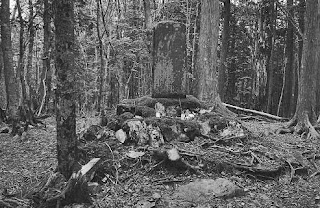
One such foray was made by none other than Tsujimura Tarō, who had recently succeeded his mentor Yamasaki as professor of geography at Tōkyō University. For the locus of his search, he chose Senjō-dake in what were now known – irrevocably, thanks to Kojima – as the Southern Japan Alps.

Climbing into one of Senjō’s elegant cirques in the summer of 1932, Tsujimura found the evidence he’d been looking for: so-called “gekritztes Geschiebe” (scratched-up debris) in the terminology borrowed from German geologists. The parallel grooves on their smooth granite surfaces clearly showed that these boulders had been ground under a body of moving ice.

Five years before the Senjō discovery, Kojima Usui had returned to Japan after a twelve-year stint as manager of the Yokohama Specie Bank’s branches in San Francisco and Los Angeles. The chance to see live glaciers in America’s coastal ranges had not changed his mind on the question of ancient ice-streams in Japan. That didn’t stop him from continuing to write voluminously about the artistry of snow and ice in the mountains.

Just a few months before Kojima’s death in 1949, he returned to the glacier question in an essay on “The Hettner Stone revisited”. His last words on the matter hint at a softening in his stance: “If these cirques and roches moutonnée were to affirm the former presence of great glaciers in the Hida, Kiso and Akaishi ranges, then there would be nothing for it but to bow down our heads at the infinitely creative ways of Nature, this strange and mysterious shaper.”

References

Main source is Ono Yugo (2010): Kojima Usui and Tsujimura Taro — Arguments in “Journal of the Japanese Alpine Club (Sangaku)”over glacial landforms in the Japanese Alps. Journal of the Japanese Alpine Club( Sangaku),105,138-154.(in Japanese)小野有五(2010): 小島烏水と辻村太郎—日本アルプスの氷河地形をめぐる『山岳』での論争—.山岳,105,138-154.

For the importance of Ogawa Takuji’s 1931 paper, see R H Grapes, History of Geomorphology and Quaternary Geology, page 185.

For account of research on Senjō-dake, see Tsujimura Tarō's 1961 paper in Chigaku Zasshi (辻村太郎、本州山地の氷河堆積物)

Tao of sawa

$
0
0

Is sawa-nobori, the Japanese art of river-climbing, just an offshoot of modern alpinism - or is it something entirely different? After pondering that question in a previous post, I came across this quotation from Mishima Yukio's novel, The Sea of Fertility:

Mahayana Buddhism, especially the Yuishiki school, interpreted the world as a torrential and swift rapids or a great white cascade which never pauses. Since the world presented the form of a waterfall, both the basic cause of that world and the basis of man's perception of it were waterfalls. It is a world that lives and dies at every moment. There is no definite proof of existence in either past or future, and only the present instant which one can touch with one's hand and see with one's eye is real.

Related post: The ahistoricity of sawa

In the matter of Mrs Weston

$
0
0
A pioneering lady alpinist in late Meiji Japan

For Japanese alpinism, 1902 marked an epoch. In August, Kojima Usui climbed Yari-ga-take, a feat that led to the founding of the Japanese Alpine Club. And, in the same month, the geographer Yamasaki Naomasa found signs that these mountains had once been glaciated.

Frances and Walter Weston  

The year was no less epochal for Walter Weston (1860-1940). On April 3, the mountaineering missionary at last married - he was now well past his forty-first birthday. The bride was Frances Emily (1872-1937), the second daughter of Sir Francis Fox, a civil engineer.

At this time, Weston was between his first and second stays in Japan, serving as the priest in charge of Christ Church at Wimbledon in Surrey. Later in the same year, Mr and Mrs Weston would take ship for Yokohama, where they would both work for the Society for the Propagation of the Gospel.

Also propagated during this stay, which lasted until 1905, was quite a bit of mountaineering. The couple's alpine adventures were later written up in Weston's second book about Japan, The Playground of the Far East (1918) - which also covers the Westons' second stint in Japan (Walter Weston's third), from 1911 to 1915.

Mrs Weston soon made the acquaintance of Mt Fuji and its notoriously fickle weather. As her husband later recorded,

Early one July, my wife and I were not only imprisoned, at a height of 10,000 feet, by a storm which raged on the mountain for three days, but our coolies refused to go to the actual summit, and we had to finish the climb alone in the tail end of the typhoon … Now, on each occasion my wife has climbed Fuji with me such storms have been our lot .

Even greater excitement awaited the Westons at Kamikōchi, the gateway to what was then being rebranded as the "Japan Northern Alps". In those days, a herd of cattle belonging to the breeding farm of the Nagano Prefectural authorities used to graze the right bank of the Azusa river. It was here, one summer afternoon, that the Westons were confronted by an angry bull:

Suddenly, to our astonished gaze presented itself the form of this fierce monster planted firmly in the path no more than a dozen yards ahead. There he stood, waving his uplifted tail, pawing the ground, and shaking his huge, sharp horns with alarming and increasing energy… At the moment my wife happened to be in front of me … In answer to an agitated exclamation, "He's coming for me, what had I better do?" the only natural reply was, "You take cover to the right, and I'll go to the left," a manoeuvre no sooner suggested than executed .

Frustrated in his efforts to gore the Westons, the bull then chased good old Kamijō Kamonji into the middle of the river. Fortunately, the mishap did nothing to dampen the faithful guide's regard for his missionary client and friend.

Yari-sawa with Yari-ga-take in the background
As her sangfroid during the bull incident would suggest, Mrs Weston did not shrink from steep ground. A photo shows her taking part in a roped ascent of Yari-ga-take, the spire-shaped peak above Kamikōchi. Just as in Weston's first visit to Yari, two decades earlier, the party was guided by old Kamijō, this time accompanied by his son and Kamijō's dog. (Sorry, Hana, this hound may have scored the first canine ascent of the spire-shaped peak.)

Climbing Yari
In the summer of 1913, the Westons headed for Shirouma, a peak that had previously eluded him. By this time, modernity had reached the Northern Japanese Alps. Trains now ran where, on his first visit to Japan back in the 1890s, Weston would have walked or taken a horse-drawn basha. A new light railway took the couple as far as Shinano-Ohmachi, from where they hired a "spacious landau" that had seen better days. At Akashina, they stayed at a hotel which advertised itself as a "station of the Japanese Alpine Club".

On foot now, they traced the "delightful route" up to Nakabusa. There, with immense pride, their host told them that one of the springs had been found by a government analyst to contain traces of radium - a prospect that the English couple "could only view with sentiments somewhat mixed".

Next morning, a four-hour scramble in the cool air of the fragrant forest took them to the ridgeline south of Tsubakurō-dake. Then they traversed over Ōtensho, before putting up for the night in a comfortable bivouac cave at Ninomata-koya. An eleven-hour tramp on the third day brought them down into Kamikōchi, where the whole onsen crew turned out to welcome them. For was the first time that a "European party" had ever traversed this route, Weston recorded.

That remark was telling – for Walter Weston, the pioneering days were over. In 1892, he’d climbed Yari years before either the Japanese surveyors or Kojima Usui got there. But now the roles were reversed – it was the gentlemen of the Japanese Alpine Club, led by Kojima himself, who had pioneered the long ridge route that the Westons had just completed.
Climbing in the Alps

All this meant that it was a bit late for Mrs Weston to break a trail of her own. The Japanese women of the Taishō era didn’t need role models from abroad – they just went climbing. As for foreign women climbing in Japan, that particular taboo had been shattered half a century before, when Mrs Parkes, wife of the British minister to Japan, accompanied her husband to the top of Mt Fuji.

Curiously, it may have been back in Europe that Mrs Weston helped to blaze a trail. Her climbs in the Swiss Alps made her eligible to join the Ladies' Alpine Club, founded in 1907 by the hard-driving Mrs Aubrey 'Lizzie' LeBlond.

Indeed, that was the only option for a lady mountaineer at the time. The original Alpine Club, of which her husband was a proud member, would not admit ladies until 1974. In Japan, piquantly, the Japanese Alpine Club formed a women's section in 1949, modernising itself more quickly than the model on which it had been founded…

A modest proposal

$
0
0
Should the Senkaku Islands be designated as a nature reserve?

Seeing that they've been in the news, I Google Earth'd over to the Senkaku (or Diaoyu) Islands. Not, of course, with the aim of stoking controversy, but just to see if there was any climbing potential. Which is rather poor, I'm sorry to report. Although the islets rise with promising steepness out of the ocean, the cliffs look loose and vegetated.


Besides, would-be climbers might disturb the short-tailed albatrosses (Phoebastria albatrus) that live there. In Japanese, this engaging bird is known as the "ahō-dori" ('foolish fowl'), a name that refers to its habit of letting people walk right up to it. In return for this trust in human nature, it was hunted almost to extinction in the nineteenth century.

Since hunting was banned, the global population has recovered to a few thousand or so - about 2,000 birds on Torishima, an island in the Izu chain, and a few hundred more on Minami-kojima, one of the Senkaku group.

Japan's Agency for Cultural Affairs long ago declared Torishima and the "ahō-dori" itself to be 'natural monuments'. Surprisingly, though, this distinction has so far eluded Minami-kojima, the bird's only other breeding ground. Now there's an idea. Perhaps it's time that the Senkaku Islands were designated a special natural monument or even a national park ...

So that I have the clear sky overhead

$
0
0
The explorer whose belly could store all the mountains and rivers of Yezo

Thanks to Japan's most famous mountain book, we know who Matsuura Takeshirō was. He was the explorer who journeyed through the wilds of Ezo (now Hokkaidō) between 1845 and 1858, laying the groundwork for the northern island's later development.

Matsuura Takeshirō 
In Nihon Hyakumeizan, Matsuura first appears as a 27-year-old wanderer, composing a poem about Akan-dake (Chapter 4) on the day after climbing this shapely 1,503-metre volcano. A few pages later, he is responsible for the naming of Biei, a town close to Tokachi-dake (Chapter 7).

In alpinistic terms, Matsuura's greatest feat was the mid-winter ascent of Yōteizan (Chapter 9), a Fuji-like stratovolcano of 1,893 metres to the south of Sapporo. He set up a shrine at the mountain's foot on February 2, 1858 and then addressed himself to the ascent, which included an overnight bivouac in subzero conditions. We next run across Matsuura's trail in the Kansai region, where he pioneered a route up Ōdai-ga-hara-yama in 1885 (Chapter 90).

So that is what Matsuura did, at least in connection with mountains. But what inspired his ceaseless wanderings? To answer that question, we have to look beyond the pages of Nihon Hyakumeizan. Fortunately for English-speakers, the explorer's life was written up by the anthropologist Frederick Starr in a slim pamphlet published in 1916.

What follows is based on Starr's account, with added detail from three other sources (see references). Starr first heard of Matsuura when he visited Hokkaidō in 1904 "to secure a group of Ainu for the outdoor ethnologic exhibit of the Lousiana Purchase Exposition at St. Louis". It turned out that Matsuura's travel journals constituted one of the most authoritative sources of information on the Ainu at that time.

 Matsuura Takeshirō's map of Hokkaidō 

Matsuura Takeshirō was born at Kitanoe in Ise Province in February 1818. His father had studied literature under Motoori Norinaga - whose "national learning" provided the intellectual underpinnings for the Emperor's Restoration in 1868 - and Takeshirō embarked on a similar education when he was sent, at the age of thirteen, to the school of Hiramatsu Rakusai in Tsu.

From the age of seventeen, Matsuura began "a remarkable series of wanderings" that took him all over Honshū, calling on men of letters, visiting shrines and places of historic interest, and climbing "notable and famous peaks". But it was while serving as a monk in a Zen temple at Nagasaki - he was now twenty-one - that news reached him of Russian ships approaching Japan's northern territories. This seems to have awakened his interest in Ezo, as Japan's northern island was then known.

Getting there took several years. One preliminary was to pay his respects to the graves of his parents, who had died during his wanderings. Another was to visit the shrines of Ise. As Starr explains:

"He desired here to pay respect to the national deities and sacred shrines, but, as a shaven priest of Buddhism, might not do so. Here was exemplified one of the most curious characteristics of the man. Though he continued his daily prayers, morning and evening, through his life, after the Buddhist fashion, he placed national loyalty above his Buddhist fervor; abandoning the priesthood, he permitted his hair to grow, and performed the duties of filial piety and national respect at Ise."


Crossing the straits

A first attempt to cross the straits of Tsugaru was rebuffed by officialdom. So it wasn't until 1845 that Matsuura at last succeeded in getting passage to Ezo, where he travelled for seven months. On his second expedition, a year later, Takeshiro travelled as far as Karafuto (Sakhalin) and Cape Shiretoko before returning to Hakodate.

Matsuura built up friendships with his Ainu guides and started learning their language. He also kept detailed journals, recording everything he saw - plants, animals, human beings, life, customs, products, soils, topography, altitudes, drainage, coastlines. More than two hundred of these note books were filled with observations.

After his third journey, which took him to Kunashiri and Etorofu in the Chishima Islands, Matsuura started to assemble his observations into a series of reports. In the end, his writings on Ezo would fill thirty-five volumes. He also drew up maps. These were astonishingly accurate given that he had only a pocket compass and his own paces to measure directions and distances.

Partly as a result of these researches, the feudal government started to wake up to the northern island's strategic importance and appointed Matsuura as a kind of commissioner between 1855 and 1859. Although these duties took him to Ezo three more times, life as an official wasn't entirely to Matsuura's liking. When he left government service, he composed the following poem:

Laugh not, men of the world!
Though my house be small
My belly can store
All the mountains and rivers of Yezo.
For wealth and honours
I care not, as the years advance, 
So that I have the clear sky overhead.


Cape Erimo, based on a sketch by Matsuura

Matsuura's retirement from public service was temporary. In 1868, the new Meiji government appointed him judge at Hakodate. The following year, he became the 'development commissioner' for the northern island and proposed that it be renamed as the "Northern Circuit" or Hokkaidō. The name has stuck. In these years, Matsuura also helped with the transfer of the capital from Kyōto to Tōkyō, and served as adjutant to the governor of the new metropolitan region.

After again retiring from public life, Matsuura devoted himself to his personal interests. His house in Tōkyō become a centre for artists, poets, and men of affairs. He expressed his admiration for Sugawara no Michizane by dedicating a series of mirrors to shrines commemorating the Heian-era scholar official. And he made a yearly journey down the Tokaidō to visit his son in Ōsaka.

Mountains were not forgotten. Between 1885 and 1887, when Matsuura was almost seventy, he "opened"Ōdai-ga-hara-yama in Yamato Province, establishing shrines at seventy-five places around the wooded massif. As in Ezo, his aims were a mixture of practical and personal: he would follow in the footsteps of the semi-legendary mountain mystic, En no Gyōja, and overcome local superstitions - at the time, local people believed that a giant serpent haunted the mountaintop. At the same time, he would discover new tracts of arable land and find himself "a burial place in a spot beautiful by nature".

The stele on Odaigahara-yama

Matsuura was not greatly interested in money; he "desired neither to have a fortune in his life-time, nor to leave money at his death". A man didn't need much; he'd accomplished his life's work in Ezo on the slenderest of means. About two years before he died, he had the idea of building a small room of one-mat size. There had already been a house in Japan measuring one and one-half mats, he said, but never one of just a single mat.

The one-mat room was built onto Matsuura's house in Kanda. His friends contributed pieces of timber or stone from various famous and historic buildings. When it was finished, in late 1886, the little structure seemed to sum up Japan's cultural heritage - it included wood from the temple of Shi-tennō-ji in Osaka, a board from the library of the Kofuku-ji, a post from the Togetsu bridge in Kyoto and scores of other precious relics.

The One-Mat Room

Matsuura never intended the one-mat room to survive him. As Fukada Kyūya records in Nihon Hyakumeizan, "In his latter years, he had built himself a tiny but elegant retreat. To an account of why he had built the little scriptorium he added the request that, when he died, its materials should become his funeral pyre and the ashes scattered on Ōdai-ga-hara-yama." (Nihon Hyakumeizan, Chapter 90)

That account is accurate as far as it goes. What Fukada doesn't tell us is that Matsuura's wishes were disregarded. As a result, and after three moves away from central Tokyo, the one-mat room can still be seen today, as part of the Taizansō villa on the grounds of International Christian University in Mitaka, Tokyo. That is one tribute to Matsuura's memory. Others include a Memorial Museum in Matsusaka City, Mie Prefecture, and - as might be expected - a stele on Ōdai-ga-hara-yama.

The statue of Matsuura at Kushiro

Yet the monument that Fukada Kyūya chooses to highlight in Nihon Hyakumeizan is a "small and inconspicuous" bronze statue that graces the front court of a public hall on a hill top in Kushiro, Hokkaidō. It shows Matsuura, writing brush in one hand and notebook in the other, gazing out in the direction of Akan-dake, as if mulling over the lines he has just composed to mark his ascent:

The wind ceases to ruffle the water. 
I retrace my way along the cliffs in my boat in the light of the setting sun. 
On the water I see the shadow of the silver-shining mountain, a thousand spans high, 
The mountain I climbed yesterday.

March 28, Ansei 5 (1858)

Akan-dake, the silver-shining mountain 

References

Fukada Kyūya, Nihon Hyakumeizan, in a forthcoming translation as One hundred mountains of Japan.

Frederick Starr, The old geographer: Matsuura Takeshiro, 1916 - reprinted by University of Michigan Library 

Henry D. Smith II,  Lessons from the One-Mat Room: Piety and Playfulness among Nineteenth-Century Japanese Antiquarians, Columbia.

Matsusaka's godparent of Hokkaido: the life of Matsuura Takeshiro, Matsuura Takeshiro Memorial Museum, Matsusaka City, Mie. 


A mountain for philosophers

$
0
0
How the Shirane Mountains of Kai, or one of them, morphed into today's Kita-dake

Once again, a reader of this blog raises a thought-provoking question. This is the message that came in from "Anon" the other day:-

My son is doing a report for school on Mount Kita in Japan. We are having trouble finding what kind of mountain range it is and the history of the mountain. Do you have any ideas or resources?

Anon’s mention of a school report reminded me of a certain Peanuts cartoon:-


“Mountains are so you can climb to the top and see where you’ve been.” How cute. But, come to think of it, Lucy’s “operational definition” is not so naïve. For, in truth, mountains – “Mount Kita” included – are quite slippery customers when you try to pin them down as concepts. The basic problem is that it’s hard to tell where one mountain stops and another begins.

On one hand, that uncertainty has led to quite a bit of debate about (for example) how many 4,000-metre peaks you have to climb in the European Alps before you can say you’ve collected them all. At issue is what qualifies as an “independent peak” – one that rises high enough above its surroundings to be deemed a mountain in its own right.

On the other hand, the question has spawned a small but dense academic literature. Here – no kidding – you’ll find philosophers and geographers agonizing about whether mountains can be considered as objectively real. As two of these savants put it, "individual mountains lack many of the properties that characterize bona fide objects [such as tables and chairs]".

Social construct or fiat object?
This being the case, the two savants (see references), lean towards the conclusion that a mountain is a social construct. In other words, Mt Everest exists only because people agree that it does:

As an object, therefore, which was delineated, marked out, demarcated, set into relief in this fashion, and thereby also named, Mount Everest exists only as a result of human beliefs and habits. In this sense Mount Everest is, like downtown Santa Barbara … a product of socially established beliefs and habits. It is a fiat object.

OK, OK, I hear you objecting, but what does all this have to do to do with “Mount Kita”? After all, one only has to go to Wikipedia to find that Kita-dake is "the second tallest mountain in Japan, after Mount Fuji, and is known as ‘the Leader of the Southern Alps’” Isn’t that clear enough?

As it turns out, though, the Leader of the Southern Alps is, epistemologically speaking, as slippery a customer as any. In his write-up in Nihon Hyakumeizan, Fukada Kyūya virtually admits as much.

Everyone knows that Fuji is Japan's highest mountain, but ask people which the second-highest is and few will be able to reply. And even when they learn that it is Kita-dake, most will be unable to tell you where the mountain is situated. If you mention Shirane in the province of Kai, you may get a flicker of recognition because it is under this name that the peak appears in a famous passage from the Tale of the Heike, a medieval martial romance:

"In dismal spirits, Shigehira traversed the ivied path at Mount Utsu and journeyed beyond Tegoshi. Snowy peaks appeared far to the north; and, upon making enquiry, he was told they were the Shirane Mountains in Kai. He expressed his feelings in verse, restraining tears:

I do not desire
to cling to this wretched life,
yet, most happily,
I have survived to behold
the Shirane Mountains of Kai."

The Three Mountains of Shirane (photo: Wikipedia)
The difficulty here is that the “Shirane” name doesn’t exactly correspond to today’s Kita-dake – it rather refers to the whole snowy ridgeline that you see from the Yamanashi plains. To be sure, some folk used “Shirane” to refer only to today’s Kita-dake. That is, unless they were writing poems, in which case they preferred “Kai-ga-ne”.

If this seems confusing, remember that there wasn’t anything special about Kita-dake in those days. Unlike nearby Kaikoma, it wasn’t much of a destination for pilgrims. Nor was it prominent in the landscape, like Mt Fuji. And nobody back then was interested in climbing mountains just because they were high.

Climbing mountains because they are high (or steep) is a new-fangled idea. In Japan, it came in with the Meiji period and its first exponent was a young banker and journalist by the name of Kojima Usui. As is well known to readers of this blog, Kojima chose Yarigatake for his mountain expedition of 1902. This was partly because he thought the spire-shaped peak was the second-highest mountain in Japan and still unclimbed. As it happened, he was headed for disappointment on both counts.

When Kojima scrambled up Yari on August 17, 1902, he found that the cramped summit was already marked by a wooden survey tower. The Army surveyors, who were preparing Japan’s first series of modern maps, had topped out before him. As they’d already surveyed the Shirane mountains, it soon became clear that Yari had to concede the title of Japan’s second-highest mountain.

It was probably the Army surveyors who decided to fix on the name Kita-dake for their new maps. “Kita-dake” – which just means ‘the northern peak’ – may have appealed to the military mind as a pragmatic way of cutting through the taxonomical confusion. After all, Kita-dake is unarguably the northernmost of what even today are known as the “Three mountains of Shirane”.

Unfortunately, it was still far from certain at that time which three summits were included in the “Shirane San-zan”. This led to a vigorous debate within the newly formed Japanese Alpine Club:-

This, of course, raises the question of which mountains the chronicle was actually referring to, an issue vigorously debated in our day by Kojima Usui and Takatō Shoku in the pages of the Sangaku journal between 1912 and 1914 (from the seventh to the ninth editions). The two protagonists brandished an impressive array of old maps and documents at each other, while third and even fourth parties uproariously stuck their oars in. While our forebears enjoyed a more leisurely pace of life than our own, as this episode suggests, one must admire the vigor with which they strove to clarify our orographic nomenclature. (Nihon Hyakumeizan)


Kita-dake, now with added "Buttress"
In the end, it was the Army’s choice of names that prevailed – they printed the maps, after all – thus deep-sixing centuries of literary usage. It is not known (to this blogger) exactly when “Kita-dake” became official. But Kojima Usui himself used that name when he visited the mountain in 1908.

It was on this trip that Kojima named Kita-dake’s most salient feature – the long rock pillar running down its east face. As no suitably rugged native word came to mind, Kojima opted for the English “buttress” – and, suitably transliterated into katakana, Kita-dake Buttress it remains to this day.

In this way, the “Shirane” of literature morphed by degrees into a thoroughly modern mountain, complete with easy approaches for hikers and a steep Buttress for alpinists to test themselves on and occasionally fall off. No wonder the name had to change too. As Fukada concludes his write-up in Nihon Hyakumeizan, “Fuji is there for everybody, but this is a mountain for philosophers.”

References

Fukada Kyūya, Nihon Hyakumeizan, soon to be published in English as One Hundred Social Constructs of Japan

Barry Smith and David M. Mark, “Do Mountains Exist ? Towards an Ontology of Landforms”, Preprint version of a paper forthcoming in Environment & Planning B (Planning and Design)

The Hyakumeizan of relative height

$
0
0
A philosophical attempt to upset the established order

Height above sea-level isn’t everything, I realised while musing on the difficulty of defining a mountain – a topic touched on in the previous post. I mean, if you climb to 4,810 metres in western Europe, you are standing on top of Mt Blanc, with the world laid out at your feet. But the same altitude in Tibet hardly raises you above the level of the dusty plateau.

The view from relative altitude

Fukada Kyūya made a nod towards that resolving that awkwardness in the afterword to his One Hundred Mountains of Japan. A mountain’s height, he suggests, is one thing; its stature quite another. In the end, though, his choice of mountains is purely personal, based mainly on their aesthetic and historical appeal. Thus the Hyakumeizan author neatly sidesteps the philosophical question of what constitutes a mountain.

Others have taken a more rigorous approach to the problem. The other day I happened on a list of one hundred mountains of the world ranked by their “primary factor” or prominence. Prominence here is defined as the minimal vertical drop from the summit one has to descend before one can ascend a higher peak. In effect, it is a measure of how far a mountain stands proud of its surroundings.

Relatively high

In this ranking, Mt Everest is still Top Mountain; indeed, it has to be, by definition, for no higher peak can be ascended. What is interesting about this ranking by prominence is what happens lower down the table. Aconcagua (6962 metres) vaults over the heads of numberless Himalayan peaks into second place. And Mt Blanc, as befits its lordly eminence over the lesser Alps, makes it all the way up into 11th place.

Clearly, it helps to be an “island peak” if you want to make a good showing in this table. As a result, big volcanoes do well – some might say disproportionately so. Even modest Mt Fuji (3776 metres) is promoted to 35th place. For their part, Kilimanjaro (5895 metres) is up there in fourth place, Damavand (5610 metres) in 12th, and Mauna Kea (4205 metres), the roof of the Hawaiian islands, in 15th.

Mention of Mauna Kea made me wonder, though. Isn’t this ranking by prominence just as arbitrary as the traditional ranking of mountains by absolute height above sea level? For, in reality, Mauna Kea rises not from the sea’s surface but from the sea floor, which on average is more than 4,800 metres deep in these parts. So the real Mauna Kea is a structure that rises almost 9,000 metres from its base – higher than Everest.


Top of the world?

This doctrine of “real topographical relief” could dangerously subvert the established order. And, in the hands of Koaze Takashi, a professor of geography at Meiji University, it does just that. Measuring from the depths of the nearby Japan Trench, reckons the professor, Mt Fuji rises a breath-taking 12,000 metres above its base. And, he estimates, Everest could only rival that elevation if the sediments in the Ganges Basin were excavated down to the offshore bedrock.

Could it be that, in terms of true planetary topography, Mt Fuji is now the highest mountain in the world?

References

The Earth: an intimate history, by Richard Fortey, for the maunderings about Mauna Kea.

Yama wo yomu (Reading mountains) by Koaze Takashi, Professor of Geography at Meiji University.

For what it's worth

$
0
0
A Taishō-era meditation on the meaning and worth of mountaineering

Is it worth it? This is the question that floats to the surface after a mountaineering accident. Following his epoch-making first ascent of the Eiger Mittelegi ridge in September 1921, Maki “Yūkō” Aritsune (1894-1989, picture left) returned to Japan and set about training up a new generation of Japanese alpinists.

At first, all went well. On March 30, 1922, he led a group of young ski-mountaineers to the top of Yari-ga-take. In the summer, he held a technical training camp in Karesawa, in the heart of the Northern Alps.

Then came nemesis: in January 1923 on Tateyama, one of Maki’s companions collapsed and died of exposure in a snowstorm. The victim, Itakura Katsunobu, was one of the most promising and experienced of Japan’s young alpinists. As the son of a former daimyō, he was also a scion of the aristocracy.

Explanations were needed, and responsibility had to be taken. Maki fulfilled both obligations in an essay entitled “On the death of Itakura Katsunobu” (板倉勝宣の死). In the opening passage, he also weighs up the meaning and worth of mountaineering itself:

The evolution from summer to winter mountaineering is a natural one. If we want to get to grips with ice and snow, we have to go to the mountains in winter. In the summer mountains, all that remains to be developed is climbing technique – that is, rock climbing or “klettern”, to use the German word. Now, if we were happy just to follow in the footsteps of our predecessors, there would be no particular problem – we would have no need to seek out any new paths for ourselves. 

But if we wish to build on the experience and knowledge of our predecessors and to push out the frontiers, even if only a little way, then we’ll always be seeking out new paths. That said, it’s quite permissible for a mountaineer to have ordinary, humdrum ambitions, as long as these don’t diverge from the true path. In any mountaineering activity worthy of the name, I believe that the people involved derive some value from it. 

In this particular case, however, I would deeply regret it if confusion were to be caused by my own failure or by the aspects of mountaineering that can invite misunderstanding. As Sir Francis Younghusband observed, one could look at mountaineering either as an art form or as the youthful spirit of a people finding expression in a sport. Yet, whatever one’s view or interpretation, mountaineering is a complex and multifaceted activity. 

As one might surmise from the existence of a word such as “oromania”, mountaineers have an undeniably compulsive disposition, one that couldn’t contemplate a life without mountains to climb. There are the delights they find in exploring the vast and beautiful mountain world of nature. There are the hardships they overcome or the tranquil state of mind they attain as they stand aloof from the world. Each mountaineer finds his own kind of satisfaction. 

One thing is constant, though; once you are dealing with the vagaries of mountains and weather, a certain level of risk is unavoidable. Some might say that it’s unwise to expose oneself to danger. I would say, rather, that one should oppose that risk by proceeding with both courage and the maximum degree of caution. To go forward not defensively but with resolve – this is surely the sound and substantial way.

References

Maki Yūkō, "On the death of Itakura Katsunobu", in selected essays published as "Mountain journeys" (山行).

Mountains of character

$
0
0
On writers who choose to write about peaks as if they were people

"A mountain becomes great as a human personality does, by extending its influence over the thoughts, words, and actions of mankind." Such are the opening words of Ten Great Mountains (1940), a title that could not fail to attract the attention of a blogger dedicated to Japan's One Hundred Mountains.

One of ten
These ten great mountains were written up by Graham ("R L G") Irving (1877-1969). A teacher of French and mathematics at Winchester, the famous English public school, Irving took a select group of his pupils to the Alps every summer and led them, without guides, up difficult ridges and faces. It was on one of these ascents that George Mallory, the most brilliant of Irving's protégées, found the inspiration for his essay comparing a day well spent in the Alps to "some great symphony".

But we digress. In selecting his mountains, Irving had to answer the same question as a later Japanese author - on what criteria should they be chosen? In the end, it was "personality" that counted. As Irving explains, "Besides actual height there are many things that contribute to make a mountain great: its position, its form, its character, its history, everything that is embodied in the personality it has developed with the spirit of man." Finally, he settled on Snowdon, Ben Nevis, Mt Cook, the Matterhorn, Ushba, Mt Blanc, Mt Logan, Nanga Parbat, Kangchenjunga and Everest.

Is it right to attribute human characteristics to the natural landscape? The art critic and mountain aesthetician John Ruskin (1819-1900) thought not. To do so, he sneered, was to commit a "pathetic fallacy". But Ruskin was a repeat offender against his own stricture. In the same book that denounces the pathetic fallacy, he did not shrink from describing mountains as "lifted towards heaven in a stillness of perpetual mercy". Or glaciers as the last resting place of archangels.

For pathetic fallaciousness was rampant in those days. In a poem of 1897, Thomas Hardy sees the rugged character of Leslie Stephen projected onto the Schreckhorn's "spare and desolate figure". A pioneer alpinist, Stephen had made the Swiss mountain's first ascent a few decades earlier. As the editor of a London journal, he'd also been the first to recognise Hardy's literary talent; perhaps the novelist and poet felt he owed him one.

Imbued with the spirit of Leslie Stephen

Objections to the pathetic fallacy have never made much headway in Japan. After all, Shinto has always taught that mountains, trees and waterfalls have souls - or share in the universal 'kami' - just as people do. Be that as it may, few of the Meiji-era Japanese mountain writers felt any qualms about transposing the natural scene into human terms.

Here, for example, is the short story and travel writer Kōda Rohan (1867-1947) describing his first encounter with the Hodaka massif:

Beyond the broad declivity in front of us rose up a noble and lofty range, manly in aspect, inspiring both awe and joy. Caught unawares, I was moved almost to tears. A reckless urge to reach out for the mountain took hold of me. For a moment, it was hard to say whether I held the mountain in my gaze or the mountain held me in his.

Kogure Ritaro
Yet more anthropomorphic in his writing style was Kogure Ritarō, the archivist and pioneer alpinist. This is Kogure on Kinpu-san, a peak in his beloved Chichibu mountains:

This is a splendid mountain. It rises in solitary state above the rest of the range and it can hold up its head in the company of any mountain in all Japan. Just as we call somebody who achieves something from the ground up a man among men, so this mountain has strength of character that makes it a mountain among mountains, compare it where you will.

Not by accident, Kogure is one of the most-quoted authorities in Japan's most famous mountain book, the Nihon Hyakumeizan ("One Hundred Mountains of Japan"). That shouldn't come as a surprise, because, just like Kogure, the Hyakumeizan author aimed to humanise his subjects: "Mountains have character in greater or smaller measure, just as people do," wrote Fukada Kyūya in the afterword to his book: "And mountains, like people, must have character."

At times, it seems that Fukada's mountains soak up the character of the people living among them. Or is it the other way round? Here is the Hyakumeizan author explaining why Chōkai has always been accorded first place among the mountains of Tōhoku.

Taking somewhat after the region’s inhabitants, the mountains of the north-east come across as heavy and solid, if not downright lumpish. Chōkai, though, is untouched by this ponderousness. The mountain seems to soar. Viewed from Sakata, one would almost say that it cuts a dash. Only an isolated peak like Chōkai, no straggling ridge, could carry this off.

Except perhaps in Tōhoku, readers of Nihon Hyakumeizan liked the way that Fukada associated them with their mountains. Soon after the book came out in 1964, it won a major literary prize. "This is one of the most original works of criticism that I've seen in recent years," remarked one of the judges. "The objects of critical thought are, in this case, mountains. The author has chosen to write about mountains as if they were people."

In Japan, this was the moment when mountains of character went mainstream.

Coming soon ...

$
0
0
... to a bookstore or a Kindle near you: One Hundred Mountains

One Hundred Mountains of Japan will be published by University of Hawai'i Press later this year. So, by Christmas, with luck, you'll be able to read your own copy of Japan's most famous mountain book, finally in English translation. O-matase shimashita; sorry to have kept you waiting.

Actually, the translation itself didn't take that long - about three years of evenings, often with a glass of red wine to wash down the dictionary work. Thank goodness for Google to look up those baffling alpine flower names. As for the classical poems that the Hyakumeizan author, Fukada Kyūya, liked to quote, they would also have been a show-stopper if the Sensei hadn't saved the day.

Then we had to find a publisher. This was the difficult part, indeed. Since Japan's economic bubble burst, vendors of Japan books in English have fallen on hard times. Two of the most prolific houses - Kodansha International and Yohan - closed their doors in recent years.

One day, a surviving one-man publisher did come up with an offer of £5,000, which sounded handsome - until it emerged that he was asking me to pay him.

While the rejection notes continued to pile up, I started this blog. The idea was to hobbyhorsically roam through the Japanese mountains and (especially) to write up the windswept and exotic personalities that historically bestrode them.

Then a funny thing happened. Pretty soon, the blog started to get attention from a new generation of windswept and exotic personalities, many of them English-speaking mountaineers living in Japan.

First to drop by was Chris White, whose hobby was bivvying out, solo, in the winter mountains. Then there was Wes, author of Tozan Tales from places never before written up in English. Then came Julian, whose fame is eclipsed only by that of his mountain-climbing terrier, Hana. And there was Iain Williams of the Toyohashi Alpine Club, who provided many a post for this blog with his volcanic scoops. Many thanks, friends, for all your support.

When it comes to fellow Hyakumeizan bloggers, I shouldn't forget to mention Tom Bouquet, then sniffing fumaroles at the University of Kagoshima. And Peter Skov, mountain photographer, whose extraordinary rendition of the Japan Alps will grace the cover of "One Hundred Mountains" (see image). If the cover sells the book, Peter, this one will go far. As will your estimable images. And many thanks too to all the readers of this blog; your comments and encouragement have kept Project Hyakumeizan rolling.

But I'm getting ahead of myself here - we still had to find a publisher. Twice, I hopped on a plane to Japan. I dropped in on Yama to Keikoku, Japan's oldest mountain publisher, and introduced myself to Mr Fukada Shintarō, the Hyakumeizan author's eldest son - who helped decide the book's English title. Meeting in a Renoir coffee shop, we discussed whether "Meizan" should be translated as 'famous mountain'. No, we thought, and so One Hundred Mountains of Japan it became.

In the end, the publishing breakthrough came via the blog. East Asia historian David Fedman left a comment on a post about Walter Weston, the mountaineering missionary who played a pivotal role in Japanese mountain matters. And maybe still does. Why not offer the book to University of Hawai'i Press, Dave suggested. And when we did, UHP said 'yes'.

There was a bit more to it than that. Academic publishers don't print anything until expert scholars have reviewed it. In this case, the imprimatur came from history professors Julia Adeney Thomas of Notre Dame, and Brett Walker of Montana State University. The book could benefit from a much longer, more thematic introduction, they recommended.

Thank you for your advice, Thomas and Walker-senseis: the book will be much the better for it. I'm also deeply obliged to Wolfram Manzenreiter of the University of Vienna, for letting me quote from his paper on what happened to Japanese mountaineering during the war. And I'm sorry that there isn't room here for a grateful mention of many other scholars for their pioneering studies of Japanese alpine history and literature.

Folk may think of translation as a solitary affair. But, as you see, this one has been more like an expedition, undertaken in the best company and washed down with many a flagon of good cheer. (Memo: don't try to outdrink history professors.) One day, good friends and colleagues, let us all go out and climb something together.

That same companionable vibe goes for One Hundred Mountains. When you get your copy, I hope you'll round up the usual suspects, stuff the book into the door-pocket of your weatherbeaten Subaru (UHP has specially designed the paperback to fit), and light out together for another of those splendid Hyakumeizan. As Fukada Kyūya said, this was a book that was written with a pair of mountain boots on. And it should be read in the same way.

Summit of achievement

$
0
0
How Satō Junichi revived the dream of an all-year weather station on Mt Fuji

When, much against his will, Nonaka Itaru was rescued from his self-imposed ordeal atop Mt Fuji in December 1895, he did what any self-respecting Chikuzen samurai would do and composed a defiant tanka:

As the catalpa bow
Springs back, so will I;
Do not believe
That for long I go

Alas, the would-be meteorologist never did get together the money to build a better summit hut. Worse still, there were many who wrote off his efforts to take mid-winter weather observations: "Nothing of serious value resulted from his enterprise," sniffed Frederick Starr, an anthropologist and Mt Fuji devotee, writing in 1924.

Mr & Mrs Nonaka
(from a movie version of their story)
But this may be unfair. Nonaka and his wife Chiyoko, who loyally supported him during their 82-day sojourn, had proved that human beings could survive, if only just, on Mt Fuji in mid-winter.

And Nonaka’s goal – to take a year-round series of high-level atmospheric pressure readings – was one that would have been endorsed by any contemporary with an interest in the accuracy of weather forecasting. Indeed, one such contemporary was no less than a prince of the realm.

By profession, Yamashina-no-miya Kikumarō (1873–1908) was a navy man. He attended the Imperial Japanese Naval Academy and received a commission as a sub-lieutenant in 1894. At about the same time, he was sent to attend the staff college of the German navy, where he no doubt got to grips with the latest meteorological thinking. Back in Japan, he decided to make his own contribution to the science and, in 1901, put up the funds to build a weather station on Mt Tsukuba.

Prince Yamashina at the
battle of Tsushima
As all Hyakumeizan fans will know, at a mere 877 metres, Tsukuba is the lowliest of Japan’s One Hundred Mountains, and building an observatory on its summit was intended only as an interim step. For Prince Yamashina’s ultimate purpose was the same as Nonaka Itaru’s – to site the world’s highest year-round weather station atop Mt Fuji. But the Nonakas’ experience may have served as a caution not to be too ambitious at the outset.

A young meteorologist by the name of Satō Junichi (1872-1970) was appointed to oversee the Tsukuba observatory. Like the Nonakas, Satō was born in northern Kyūshū – the obstinacy sometimes attributed to natives of this region may be a not irrelevant character trait when it comes to siting weather stations atop high mountains – but, in 1893, he’d gone up to Tokyo to study at a scientific institute (東京物理学校).

In January 1907, twelve years after the Nonaka adventure, Satō scaled Mt Fuji to see for himself if it would be possible to survive up there in mid-winter. The weather was fine and the successful climb filled him with confidence. Then came an unexpected blow: in May the following year, the sudden death of Prince Yamashina deprived the Mt Fuji project of its main patron and sponsor. Satō was forced to look for alternative employment.

Satoh Junichi
In 1920, he shipped out to Japan’s recently acquired territory of Karafuto for a four-year stint as the head of the meteorological observatory. In his novel about Satō’s life, Nitta Jirō speculates that the meteorologist was attracted by the island’s extreme climate – in mid-winter, trees are said to explode with the cold. Indeed, the parallels between Sakhalin and the summit of Mt Fuji in winter cannot have escaped the would-be high-altitude researcher.

Two years after Satō’s return to Honshū, in 1926, a private benefactor (鈴木靖二) offered to fund the construction of a Mt Fuji observatory and Satō was appointed to lead the project. The following year, a small hut, large enough for Satō and a few government meteorologists, was completed at Yasu-no-kawara, a flattish area on the south-eastern rim of Mt Fuji’s crater. For the time being, though, observations would only be taken during the summer.

That would not satisfy Satō for long. And time was pressing – he was now 56 years old. In December 1927, he set off from Gotenba, accompanied by a few young meteorologists, to attempt another winter ascent of Mt Fuji. But the upper slopes were frozen so hard that their crampons wouldn’t bite, and they were forced to turn back. A similar attempt in December two years later also failed. Now time was running out.

On January 3, 1930, Satō set out again, this time accompanied only by the porter, Kaji Fusakichi (1900-1967), who would one day be famous for climbing Mt Fuji a record 1,672 times during his lengthy career. This ascent has taken on the stature of a minor epic within the annals of Mt Fuji.

Somewhere above the seventh station, in a storm of wind, Satō lost his footing and took a long, battering fall down the icy slope, knocking himself out on the way. But Kaji revived him, and the pair reached the summit hut as night was falling.

Once there, they settled in for a long stay. Too long, perhaps. Deprived of fresh food, Satō started to suffer from beriberi, a deficiency disease that probably increased his vulnerability to frostbite. Yet when Kaji urged him to retreat, he retorted that he didn’t want to become “a second Nonaka Itaru”. And so they held out until February 7 before descending. By that time, some of his fingers had been blackened by the frost back to the second joint.

Commissioning the summit observatory atop Mt Fuji
on August, 1, 1932
In the end, Satō did not risk his digits in vain. His exploit - and, no doubt, his gaman - had impressed the public and, even more importantly, the meteorological establishment. In the following summer, the summit hut was rebuilt, expanded and, on August 1, 1932, formally put into commission as the Provisional Mt Fuji Summit Observatory of the Central Meteorological Office.

On that August day, after the ceremonies and the group photograph, Satō prepared to descend the mountain. He was 61 years old; from then on, the station would be run by alternating monthly teams of young Met Office staff, year in, year out. He would no longer be needed.

Before he left, though, there was one more note to write up in the hut logbook: “Anemometer contacts are worn; need to be replaced.” And with that injunction, the old meteorologist set off down the burning slopes of the Gotenba trail for the last time.

References

Frederick Starr, Fujiyama: the Sacred Mountain of Japan, 1924

Chiyoko’s Fuji: Selected excerpts from the English translation of Fuyō-Nikki, 1896, translation by Harumi Yamada, 2013

Fuji-san: oinaru shizen no kensho, Yomiuri Shinbunsha, 1992

Obituary for Satō Junichi from Japan Meteorological Society Journal

Images and ink

$
0
0


Image: "The foot of Hodaka-dake" by Ōshita Tōjiro (1870-1911)

Ink: On Hodaka-dake, from Nihon Hyakumeizan (One Hundred Mountains of Japan) by Fukada Kyūya (1964):

This shows that Hodaka has attracted reverence as a holy mountain from ancient times. Its ruggedness, however, meant that people preferred to adore it from a distance rather than make pilgrimages to its summit. Hodaka is so rugged, indeed, that it remained inviolate long after the summits of nearby Yari and Kasa-ga-dake succumbed to pious monks. 

It was not until the summer of the fourteenth year of Bunka (1817) that Takashima Shōtei, a doctor from Hodaka village in Azumi-gun, visited the mountain with a friend and sketched its topography. But judging from the written account that he left, the pair did not reach the summit...

Mt Fuji at war

$
0
0
How Japan's mountain-top meteorologists rode out the dark years of early Shōwa

War comes to Mt Fuji 
War came to Mt Fuji on July 30, 1945. For months, the meteorologists at the summit station had watched streams of enemy aircraft drone overhead. And so they saw nothing unusual about the six-ship formation that roared past just after 8am. Until two planes peeled off from the main swarm and came howling in towards them. Seconds later, the spent cartridges came spilling from the fighters’ wings and the air was filled with noise, shattering glass and flying splinters…

In retrospect, one might say that the road to war started in the previous decade, on another fine summer's day. It was on August 1, 1932 that Japan’s Central Meteorological Office commissioned its first officially funded observatory on Mt Fuji. Gathered round the small summit hut almost four kilometres above sea-level – yes, that’s Satō Junichi in the photo below, standing in the hut's doorway – the weathermen must have felt themselves as far above the era’s murky politics and foreign policy as “clouds from mud”.

Inaugurating the Mt Fuji observatory on August 1, 1932
Yet the events then unfolding in China would one day embroil these men too. Ten months earlier, the Japanese army had invaded Manchuria. In an act of insubordination that was swiftly termed “gekokujō” (下克上), the local army officers made their move without getting authorization from either the government or, indeed, their own general staff.

Whether or not the military had inspired them, the meteorologists were soon moved to stage an act of gekokujō for themselves. This was because the government had seen fit to approve just one year of continuous weather observations atop Mt Fuji, as part of Japan’s contribution to the Second International Polar Year in 1932-33.

As a single year’s weather readings would be scientifically of little worth, the government’s stinginess made no sense to the weathermen. So, in mid-December 1933, when the last approved summit crew were ordered to bring down the portable gear when they finished their month-long shift, they fell to plotting. How would it be, they mused, if they just sat out the winter in the summit hut, continuing their work in a kind of high-altitude sit-in strike.

No excuses were necessary
The team leader – not to say ring leader – in this enterprise was Fujimura Ikuo, who later went on to head up the observatory in a meteorological career spanning three decades. At first, he and his crew cast about for some plausible-sounding pretexts for disobeying their orders – for instance, the slopes would be too icy to let them bring down delicate instruments, and so they’d have to stay on at the summit to look after the kit.

In the event, they made no such excuses. On arriving at the summit, they simply told the outgoing shift that they would stay until summer and keep up the observations. With that, Fujimura handed over a missive to the Meteorological Office’s directors and, together with his rebel crew, shut himself up for the winter. Fortunately, his resolve wasn’t put to the test. On New Year’s Eve, a telegram arrived from Fujimura’s superiors: “Observations temporarily extended; you are instructed to descend when relief crew arrives.”

The following September, the funding crisis was eased when a foundation set up by the Mitsui zaibatsu stumped up seven thousand yen. A year later, in October 1935, the government switched the summit station’s funding to the regular budget, so that it could continue operating indefinitely. To mark this promotion, the adjective “Provisional” was removed from the observatory’s designation.

Mitsui comes up
with the cash
The government also granted funds to build a new and improved hut close to Ken-ga-mine, Mt Fuji’s highest point – the buffeting airflow at the old site had interfered with pressure readings. There was even talk of a cable car to waft the relief crews effortlessly to the summit, although these plans came to nothing. But the new hut was duly opened in 1937 and one more building in 1940.

By 1944, Japan’s early successes in the war had become a liability. Lines of supply were overstretched. In fact, even keeping in touch with far-flung units of the Imperial forces had become problematic. Thus, the summit of Mt Fuji was the natural place for the military to look when seeking a better way to communicate with the radio relay station on Hachijō-jima, an island about 300 kilometres south of Tokyo. Better still, there was no need to build a new shed for the radio gear – they could house it in the meteorologists’ old hut at Yasu-no-kawara.

Furnishing a power supply was the biggest challenge. The plan was to sling a high-tension cable on poles between the city of Gotemba and the mountain’s 1,600-metre contour. After that, the cable would run underground all the way to the summit. The work of laying the cable was assigned to a squad of five hundred soldiers, who used ‘human wave’ tactics to complete the job in a blistering two weeks.

The new power supply brought more than one benefit – it put an end to the worst job at the summit station; cranking up the generator in winter. When the frigid temperatures had congealed the lubricating oil to candy-like stiffness, the duty man might be spitting blood by the time he got the motor started. Or, if the generator refused to start, the batteries would run flat, forcing the weathermen to cook by the light of candles. Once at least, the candles ran out too and rush-lights were rigged to burn the cooking oil, all this in temperatures of minus 30°C.

Soon the summit crews had more to worry about than scanty provisions and the icicles that formed in their sleeping quarters. Yajima Hiroshi had only just joined them on the mountain when he was called up for military service. On December 3, 1944, in a ferocious blizzard – the wind was gusting at a hundred kilometres an hour – Yajima set off with two colleagues to fight his way down to Gotemba. After that, he shipped out to Io-jima and was never seen again.

On March 13, 1945, one of the weathermen climbed the observation tower above the hut and, looking westwards in the direction of Nagoya, saw a reddish glow in the sky, beyond the shoulder of Akaishi-dake. Soon the spectacle would be repeated, and in almost all quadrants of the compass. Feelings of despair overcame the summit crews as, night after night, they watched these false dawns.

On July 18, five men from the army’s own meteorological service came up to the summit to launch weather balloons. Their brief was to check if the incendiary balloons then being launched by the military were flying high enough to ride the jet stream all the way to America. In fact, the balloons were already doing enough damage for the US authorities to impose a news blackout. One device even cut the power supply to the Hanford plutonium plant in Washington State.

Hacking ice from the instrument tower
By chance, it was at the end of the same month that the two enemy fighters made their strafing attack on the summit observatory. By a miracle, nobody was killed although some of the weathermen suffered bruises and scratches from ricocheting debris. And, although the 50-calibre bullets riddled the observation towers and smashed an instrument box, most of the precious equipment was unscathed.

In the end, Mt Fuji itself was a far more dangerous adversary than anything the Americans could launch at the meteorologists. The first casualty came in a snowstorm in April 1944, when 19 year-old Imamura Ichirō lost the way during a routine ascent as a member of the monthly relief crew. He stumbled blindly down the mountain before succumbing to exposure near the fourth-station level. The rescuers found him propped against a rock, as if he’d sat down to rest and never woken up.

The next mishap occurred in December 1946, when Koide Mutsurō slipped and fell from the ninth station. He was just 28. It is surely no coincidence that, of the four fatalities during the summit station’s six decades of operation, these two accidents closely bracketed the war’s end. As if climbing the mountain in winter was not already dangerous enough, the deck would have been stacked higher still against the weathermen by short rations, the blunted ice-axes and crampons, the lack of proper winter mountaineering kit.

Were these sacrifices worth it? This blogger cannot say what the Mt Fuji station might have added to the sum of meteorological knowledge. But by proving that men could survive and work in the extreme conditions of the summit, the summit crew did pave the way for a yet more ambitious project than year-round weather observations – the mountaintop radar that went into service in 1965 with the aim of saving thousands, or perhaps tens of thousands, of Japanese lives. This, though, is another story.


References

Fuji-san: oinaru shizen no kensho, Yomiuri Shinbunsha, 1992; also for images of summit hut, ice clearance and radar station.

Timeline for Mt Fuji's modern history, from the project to re-utilise the summit station.

In praise of shadows

$
0
0
When mountains, and literary speculations, project themselves to far horizons

I must fess up – the sonorous title for this post was borrowed from no less an author than Tanizaki Junichirō. Or rather from the English translation of his famous essay on Japanese aesthetics, In'ei Raisan (陰翳礼讃).

The shadow of Kaimon-dake

But the shadows we praise here are those that stretch away from mountain summits at dawn or dusk, like pyramids of twilight reaching out to infinity. All great summits – Mt Blanc, the Matterhorn – trail their attendant cones of darkness, and the famous mountains of Japan are no exception.

The shadow of Mt Blanc at dawn

As you’d expect, some set-piece shadows show up in Japan’s most famous mountain book. Here for example is the sunrise as seen from the top of Asahi-dake, a Meizan of Tōhoku:-

Thirty-four years before, we had saluted a peerless dawn there under a cloudless sky. Then, deeply impressed, we watched as Ō-Asahi unfurled its pyramidal shadow far across the Sea of Japan.

When the poet Yūki Aisōka, a native of Yamagata, climbed Ō-Asahi in his sixtieth year, he left to posterity these magnificent lines:

All my life I will treasure this memory
How the sun rose from the Pacific and touched the Ōu mountains
And, as it rose, how Asahi’s huge shadow settled over the Japanese Sea.

Having witnessed the scene for myself, I find this poem strikes a deep chord. (Nihon Hyakumeizan)


Shadow to infinity

And, at the other end of Honshū, there is a spectacular sunrise on Daisen:-

It was in the Renjō-in, a cloister attached to this temple, that the author Shiga Naoya stayed while he was writing his masterpiece, A dark night's passing (Anya koro). At the end of this book, the hero Tokitō Kensaku sets off to climb Daisen but gives up from exhaustion. A strange feeling of rapture overtakes him. In a masterly piece of description, he watches as the dawn breaks below him and Daisen's shadow slowly retreats over the land. "And so Kensaku watched with emotion this rare sight – the shadow of the proud mountain, the greatest in central Japan, etched boldly across the land."(Nihon Hyakumeizan)


To make amends for stealing Tanizaki’s title, I leafed through Nihon Hyakumeizan to see if the novelist gets a mention. Alas, he is cited but once in the book, and that is in the chapter on Ōdai-ga-hara-yama, which is at least a Kansai mountain. But the context has nothing to do with shadows.

When you think about it, allusions to Tanizaki were always going to be sparse in Nihon Hyakumeizan. If Fukada Kyūya was one of Japan’s best-loved outdoor authors, then the great chronicler of Kansai life was all about interiors. Tanizaki's most famous essay is a disquisition on the charms of shade and gloom within the traditional Japanese house:-

And so it has come to be that the beauty of a Japanese room depends on a variation of shadows, heavy shadows against light shadows—it has nothing else. Westerners are amazed at the simplicity of Japanese rooms, perceiving in them no more than ashen walls bereft of ornament. Their reaction is understandable, but it betrays a failure to comprehend the mystery of shadows. (In praise of shadows)

At a deeper level, though, Tanizaki’s theme is the clash of old and new, tradition and modernity, Western brashness and Japanese taste. In short, it is an elegy for Japan as it once was. And that is a platform that the Hyakumeizan author would probably have endorsed wholeheartedly.

After all, Fukada was no fan of modernity when it came to the new roads, resorts and ski pistes that were even then gnawing into his beloved mountains. Here he is on Kita-dake, for example:-

In recent years, a tunnel for road traffic has been driven from the village of Ashiyasu under the Yashajin pass to Hirogawara in the Noro river valley. Its seclusion stripped away, Kita-dake is now easily accessible, a fact that some applaud and others bewail. You will find me in the latter party.


Before putting up this post, I took one more look at Tanizaki’s essay and found the following on the very last page:-

The author of “Vox Populi Vox Dei” column in the Osaka Asahi recently castigated city officials who quite needlessly cut a swath through a forest and leveled a hill in order to build a highway through Minō Park. I was somewhat encouraged; for to snatch away from us even the darkness beneath trees that stand deep in the forest is the most heartless of crimes.

So it may have been overhasty to categorise Tanizaki as entirely an indoor writer. Indeed, when it comes to eulogising the shadows beneath old trees, there’s very little daylight, so to speak, between his standpoint and Fukada’s. Perhaps the two authors had more in common than might appear at first sight.

Shadow of sunrise from the Aletschhorn

People of the Lotus reprised

$
0
0
NHK revives an epic story of mid-winter survival atop Mt Fuji

“Meiji 28 (1895): Nonaka Chiyoko (Matsushita Nao) is praying for the safe return of her husband, Itaru (Satō Ryuta), who is attempting the first-ever mid-winter climb to the summit of Mt Fuji. If he succeeds, he’s determined to build a hut on the mountaintop and shut himself up there all through the next winter taking high-altitude weather observations. But Chiyoko is afraid that, if he goes up there alone, he’ll never come back…”


If this plot-line sounds familiar, that may be because you read it here first, on this very blog. This time, though, the true story of how Chiyoko saved her husband from sacrificing himself to science is being retold by NHK, Japan’s national broadcaster. Entitled Fuyō no Hito, the new six-part “Saturday drama” started on July 26.

This is not the first time that NHK has revived the Nonaka story. In April 1982, a two-part drama was aired with the aptly named Fuji Mariko playing Chiyoko. An English-language guide to Japanese TV notes that the NHK Children’s Division adapted the story “presumably as a means of introducing young viewers to the science of weather”.

Actually, that last remark may need to be taken with a pinch of salt. It’s true that, ever since Itaru and Chiyoko were rescued from their mountaintop ordeal in late December, their story has periodically played to packed houses. In fact, a stage drama about them was put on at the Tokyo Ichimuraza theatre as soon as February 1896. But it probably didn’t dwell much on the science of the weather.


Just before that play opened, Chiyoko finished publishing her own account of the adventure in the Hōchi Shinbun. Again, meteorological details are scant inFuyō Nikki (Journal of the Lotus), which, as the title suggests, is written in the style of a traditional travel diary. The lotus, by the way, is a nod to the traditional perception of Mt Fuji’s crater as a sacred mandala in the form of a gigantic lotus blossom.

In the autumn of the same year, the poet and author Ochiai Naobumi published a book-length account of the Nonaka story, Takane no yuki (High mountain snows), drawing heavily on Chiyoko’s diary. Then, a few years later, Itaru came out with his own guide to Mt Fuji (Fuji Annai). As you would expect, this account does make ample reference to the science of weather but, by that time, most people had lost interest.

After that, Mr and Mrs Nonaka were largely forgotten until 1948, when Hashimoto Eikichi published a novelistic rendition of their adventure. According to Andrew Bernstein, whose account I rely on here, the timing was not fortuitous: the novel was clearly meant to inspire people during the hard post-war years "by celebrating a Japanese man and woman who had endured the unendurable”.

Be that as it may, the meteorologist and novelist Nitta Jirō thought that Hashimoto had underplayed Chiyoko’s role in the couple’s survival. And so, in 1971, he published his own novel, Fuyō no Hito (People of the Lotus), in which the story is told mainly from Chiyoko’s viewpoint.

It is Nitta’s version that has won out, providing both NHK dramas with their storylines and title. You can watch the second episode of the current NHK Fuyō no Hito this Saturday, August 2. (Sorry for failing to publish this post in time for you to catch the first.)

Judging from the trailer, the series will make the most of a human drama set amid a landscape of almost inhuman severity. But brace yourself for a disappointment if you expect to be introduced to the science of weather.

References

Andrew Bernstein, Weathering Fuji: Marriage, Meteorology, and the Meiji Bodyscape, in Japan at nature's edge : the environmental context of a global power, edited by Ian Jared Miller; Julia Adeney Thomas; Brett L Walker.

The Dorama Encyclopedia: A Guide to Japanese TV Drama Since 1953, Jonathan Clements, ‎Motoko Tamamuro

Asahi Shinbun marks Hyakumeizan's jubilee

$
0
0
Tensei Jingo (“Vox Populi, Vox Dei”) is a daily column that runs on the front page of the Asahi Shimbun, one of Japan’s most popular and revered newspapers. On July 26, the column wrote about Nihon Hyakumeizan, which was published fifty years ago this summer. Here is the article in full:-

Fukada Kyuya (Asahi Shinbun
file photo)
Many Japanese people have probably heard of the book "Nihon Hyaku Meizan" (Japan's 100 famous mountains), even if they are not familiar with the name of its author, Kyuya Fukada (1903-1971). Published in the month of July exactly 50 years ago, the book has remained a perennial favorite of mountain lovers, not a few of whom have made it a lifelong project to climb all the 100 mountains selected by Fukada.

On July 20, the 50th anniversary of the publication of the book was celebrated in Fukada's native city of Kaga, Ishikawa Prefecture, with the unveiling of a commemorative monument.

Fukada is often dubbed "the man of letters of the mountain." Given his track record as a mountaineer, he was certainly not just a writer whose hobby was dabbling in mountain climbing. Even though he was born during the Meiji Era (1868-1912), he explored the Himalayas and called himself a "romantic pilgrim."

Fukada climbed every one of the 100 mountains he selected for his book, rating them by their history and his own standard of the mountain's "dignity" and "personality." In describing how he felt when he had to reject a mountain that fell slightly short of his "passing mark," he noted, "I felt the sort of agony a teacher would feel when he has to fail his beloved pupil."

Rereading the book, I was deeply impressed by his wealth of knowledge and perceptiveness. For instance, he describes iconic Mount Fuji as "one big simple entity that needs no cheap tricks" and adds, "Toddlers can draw Mount Fuji, but even the greatest artists struggle to capture its essence." His words hit the nail on the head

Out of curiosity, I counted the number of mountains I have scaled so far. The total is 51, the majority of which are "conquests" from my younger days. I was an avid mountaineer back then, and one mountain led to another. Unfortunately, I have since been reduced to only fantasizing about the refreshing mountain breeze while I bake in the city's brutal heat.

"There are 100 delights atop 100 mountains," Fukada once noted. He was probably referring to the 100 mountains he selected, but it can also be interpreted to mean that each mountain is delightful in its own way. The eagerly awaited summer holiday season is here. Challenging one of those famed peaks would be a great idea, but heading to any of the lesser known mountains could be just as nice. But one word of advice: Take every safety precaution if you want to have a delightful time.

References

Text and photo by courtesy of the Asahi Shimbun, July 26 edition. And many thanks to Taka for bringing the English version to my attention!

The Big White Peak

$
0
0
A forgotten photo collection reveals the Hyakumeizan author climbing in the Himalaya

Second-hand bookshops can be serendipitous. I recently emerged from one near Basel Station clutching, for a paltry five Swiss francs, a collection of faded colour photos of the Himalaya. The photographer's name - Kazami Takahide - had caught my eye. Needless to say, there was a connection with the author of Japan's most famous mountain book.

It happened like this. In the mid-1950s, Fukada Kyūya was a jobbing writer for mountaineering magazines. Perhaps inspired by the French ascent of Annapurna in 1950, he was increasingly interested in Himalayan topics. This led to a series of articles in the mountaineering journal Gakujin from June 1953, just after the first Japanese attempt on Manaslu, the world's eighth highest mountain.

Unfortunately, the income from these articles was substantially consumed by Fukada's almost compulsive purchases of books about the Himalaya, many imported expensively from abroad. To rid the house of tottering piles of alpine literature, his wife later took advantage of her husband's absence on a mountaineering trip to build a book-shed in the garden.

In 1956, the Japanese collected their own 8,000-metre trophy. The veteran climber Maki "Yukō" Aritsune led the Japanese Alpine Club's third expedition to Manaslu, enabling Imanishi Toshio and Sherpa Gyalzen Norbu to reach the summit on May 9. Their success helped to stoke a mountaineering and skiing boom in Japan.

It also fired Fukada's own Himalayan ambitions. A Japanese Alpine Club member himself, he was now well enough known in mountaineering circles to find generous corporate support for a private expedition, although it was organized several years before ordinary Japanese citizens could easily travel abroad.

With three companions, Fukada took ship for Calcutta in the spring of 1958, arriving in Kathmandu some forty-five days after leaving Kobe. With Fukada at the head of fifty porters, an experience that made him feel like Napoleon, the expedition then marched to its base camp in the Jugal Himal.

Their intended mountain, today known as Loengpo Gang (7,083m), had been named Big White Peak three years earlier by a party of Scottish lady alpinists who climbed one of its neighbours. It was a wildly ambitious objective. Three high camps would be necessary to reach the summit, the Japanese party judged.

The comforts of Camp Three were scant. By the time it was established at 5,000 meters, the party's lack of high-altitude climbing experience was starting to tell. Age too may have had something to do with it; as Fukada had put it to a journalist just before leaving Japan, he was "only" 54 years old. Just to clamber in and out of the high-altitude tent's round hatch during a blizzard was a torment that had to be repeated several times a night.

The expedition photographer did manage to reach the east ridge by taking turns to break trail with a Sherpa companion. There the brown plains of Tibet were glimpsed through the clouds. Honour satisfied, Fukada decided to abandon the peak, impressing one colleague with his Buddhist spirit of self-abnegation. The party then moved on to the Langtang Himalaya and, after two months under canvas, back to Kathmandu.

The high-climbing expedition photographer was none other than Kazami Takahide. In the blurb to the English-language edition of his photobook The Himalayas, he is introduced as follows:-

"The author . was born in 1914. In 1943 he joined the Japanese Navy, where he did a three-year tour of duty, after which he managed a Ginza camera shop and and then the Sanei photo library, both in Tokyo. He has made several journeys in India and Southeast Asia. His most absorbing interest has always been high-mountain photography, and he is author of several books on the subject."

In his preface to The Himalayas, Kazami is curiously reticent about his participation in Fukada's expedition. All he vouchsafes about that experience is this: "In 1958 I spent a couple of months in Nepal, where I fell in love - with Nepal." To be sure, most of the photos in the book were taken on a later trip, in 1964, which he undertook specifically to take photos of the land and people.

Yet a few images from the Fukada expedition do creep into The Himalayas. On page 112, for example, there is an image of a Camp 3 in the Jugal Himal (see picture left). The mountain is not identified but the height given - 23,240 feet - makes it clear that the peak in the background is Big White Peak or Loengpo Gang. One glance at those Big Bad Ridges shows why Team Fukada would never get anywhere near the top.

Looking again at the photo, my attention was drawn to the figure standing in the foreground. As there were only four Japanese mountaineers on this trip (or was it three?), this is likely to be Fukada himself. The comb-over hairstyle is also a giveaway. But there is no way of knowing for certain.

As an expedition, the attempt on Big White Peak was somewhat of a fiasco. That's not to say that the effort was wasted. Sometimes it takes an overseas trip to make you appreciate your native land. The Himlayan trip may have done that for Fukada. On returning to Tokyo, he revived a project that he had been mulling for years - to portray one hundred of Japan's most eminent mountains. And the rest, as they say, is history.

References

Tazawa, Takuya, Hyakumeizan no Hito, TBS Britannica, 2003.

Photos from Kazami, Takahide, The Himalayas, Kodansha International, 1967.

Viewing all 568 articles
Browse latest View live